
U.S.-China Cooperation on the Belt and Road Initiative
and Corresponding Ideas in Chinese and Western Philosophy
April 13-14, 2017
New York City
Connecting the Bering Strait:
Joining the Americas to the
Belt and Road Initiative
by
Hal Cooper Jr., PhD, P.E.
Transcript:
Connecting the Bering Strait:
Joining the Americas to the
Belt and Road Initiative
A PDF version of this transcript appears in the May 5, 2017 issue of Executive Intelligence Review and is re-published here with permission.
Hal Cooper |
Rail expert Hal Cooper addressed the Second Panel of the Schiller Institute Conference on April 13. He was introduced by Dennis Speed.
Dennis Speed: The ambassador from the United States to China, Anson Burlingame, whom Lincoln sent there, and people like Cassius Marcellus Clay, whom Lincoln sent to Russia, have dreamed of what the next speaker has illustrated and has believed in, and has taught for decades. I want people to understand whom they’re hearing from right now. He has not just lived that dream; he has made that dream his life’s work, and it’s important that you understand that you are honored to hear from him. This is Mr. Hal Cooper, chairman of the Seattle Freight Transport Board.
Hal Cooper: I thank you very much. It’s good to be back in New York. I grew up very close to here and it’s nice to be back in New York City again.
Figure 1
View full size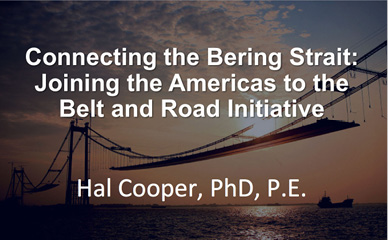 |
Figure 2
View full size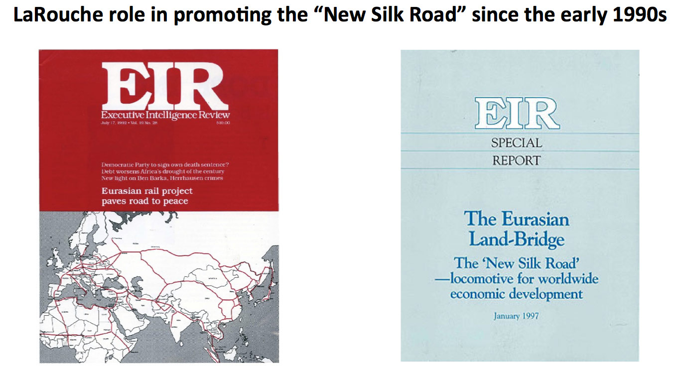 |
[Fig. 1] This is connecting the Bering Strait and the Americas to the Belt and Road Initiative in Asia. This is a concept that really began a number of years ago. When I first joined the LaRouche organization back in 1991, we began talking about this concept [Fig. 2]. I think we pushed forward on that, and that of course, has led us to where we are today.
Helga, I’m very glad to have you here, Guten Tag. It’s very good to have you here back in the United States. The last time we saw each other, we were in Germany. I’m very glad that the LaRouche Movement, and Helga and Lyn in particular, have pushed for this so much, and for so long, to really be thinking about beginning the implementation of the Eurasian Land-Bridge. We’re so thankful that China and the other countries in Eurasia have jumped on board on this to make it a reality. It is certainly in the process of happening now.
Figure 3
View full size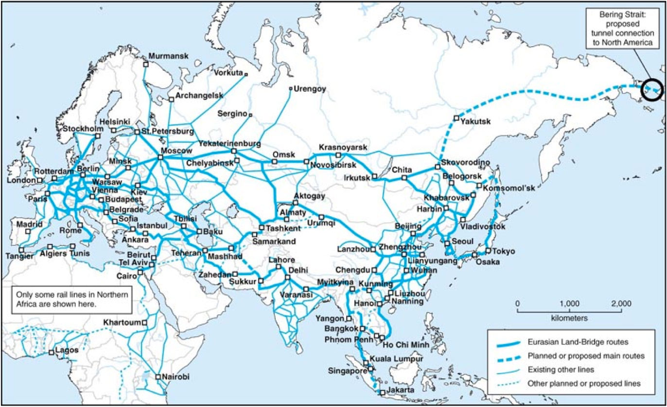 |
Figure 4
View full size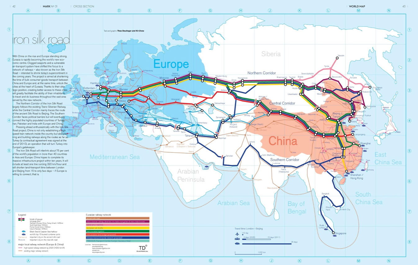 |
This is “The Eurasian Land-Bridge” report of 1997, in which we printed the map of the network [Fig. 3]. This is Eurasia. There is certainly a dotted line going to the Bering Strait from Yakutsk. Actually, that line from Skovorodino to Yakutsk is basically a solid line. There is agreement in Eurasia now to implement a very extensive transportation network which provides for economic growth and development. It is something that has to be extended to North and South America.
[Fig. 4] The Eurasian Land-Bridge concept is now in implementation. There are three major routes. There is the northern route which goes basically along the Trans-Siberian Railway. Then we have the Eurasian Land-Bridge from China, to connect to the Trans-Siberian Railway. Then we have the southern route—actually there are some other variations of that, and additional lines that connect. But you can see that there already is major interaction—a lot of traffic that is moving. We heard comments this morning of trains going between England and Europe and China. That is also going on along the southern route. There is traffic now between China and Istanbul in Turkey. I was in Istanbul in October 2008 for the international railway conference, in which a lot of this was getting started, and they had gotten to the point of talking about tariffs and things that require regulations. But the basic structure is now in the process of very much being put in place, and needs to be expanded—including to Africa and throughout the Middle East.
Figure 5
View full size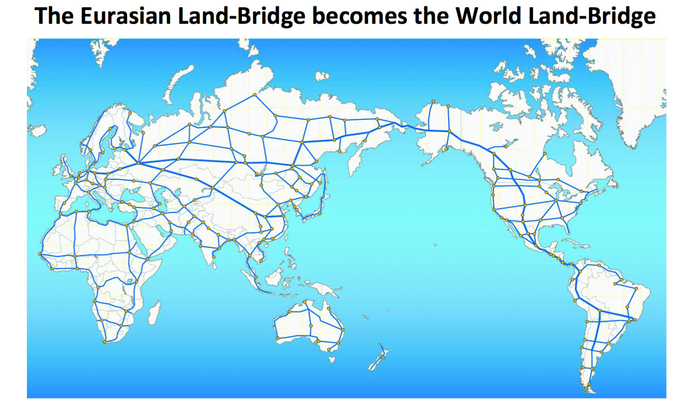 |
Figure 6
View full size |
[Fig. 5] This is the World Land-Bridge concept and implementation based on the Eurasian Land-Bridge. Notice that is now connecting—or will connect—all of the world’s continents. In the United States, we have to connect Alaska with Canada, and with the West Coast corridor. We need to connect back to the Midwest and the Eastern United States where the majority of the population and economic activity is. But we certainly do need the West Coast corridor.
There are three major infrastructure projects that need to be done. One, of course, is the Bering Strait tunnel. The second is the Fraser River Canyon, east of Vancouver, between Hope and Kamloops, British Columbia. Then, of course, the third is going down between Central and South America at the Darien Gap in southern Panama and northwestern Colombia.
[Fig. 6] The LaRouche Movement has published numerous documents related to the World Land-Bridge, in which this concept is actually presented in a way that really provides the pathway to bring it to reality. With their leadership, with Lyn and Helga in particular leading the charge on this, this is gradually becoming a reality, and of course, the very critical support of the government in China and the neighboring countries—which needs to be extended through Russia to the United States. It’s very important to connect the Bering Strait and the critical landmass between Europe and Asia, so that world development becomes Pacific-centered, rather than Atlantic-centered, which is based on stagnation as we’re seeing, because of the London-New York axis, which unfortunately still has too much influence in the United States.
Figure 7
View full size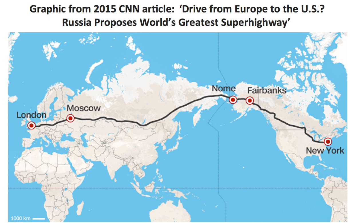 |
Figure 8
View full size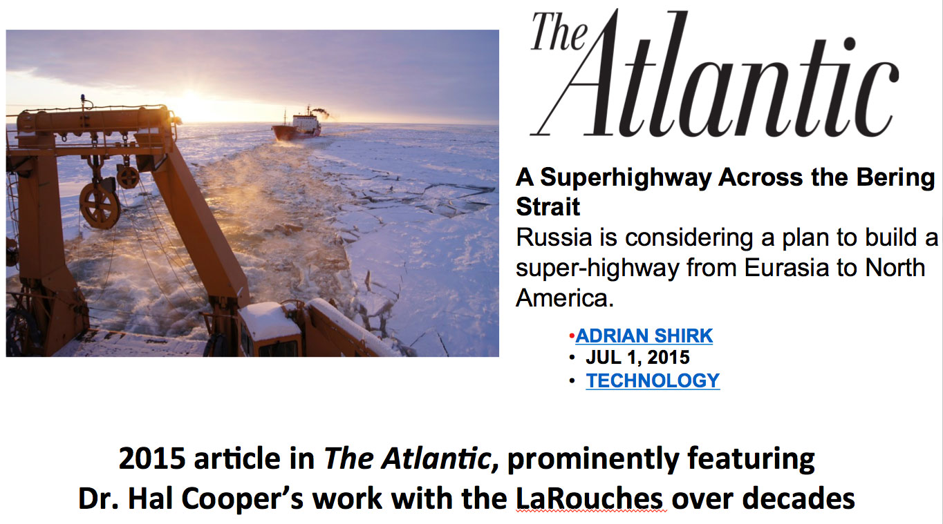 |
[Fig. 7] The idea of having a rail line and a highway between New York and London was actually proposed by Vladimir Yakunin, then President of the Russian Railways. That really locates the Bering Strait as the critical link. In this case, it would be going down through the prairie provinces of Canada from Alaska, through the upper Midwest of the United States through Minneapolis and St. Paul to Chicago, then east through Cleveland and Pittsburgh to New York. That would certainly be a long-distance and a long-term model which we need to implement, but there also need to be corridors going to the south along the West Coast as well.
[Fig. 8] There was an article that was published in the Atlantic Monthly in July 2015, in which I was interviewed, Mr. Yakunin from the Russian Railway was interviewed, as well as a gentleman by the name of Fyodor Soloviev from Alaska. We were all interviewed about the possibilities of building a Bering Strait Tunnel. There was also an alternative bridge, although with the meteorology there, that might not be the best way to go. But certainly there is a basis for connection.
Figure 9
View full size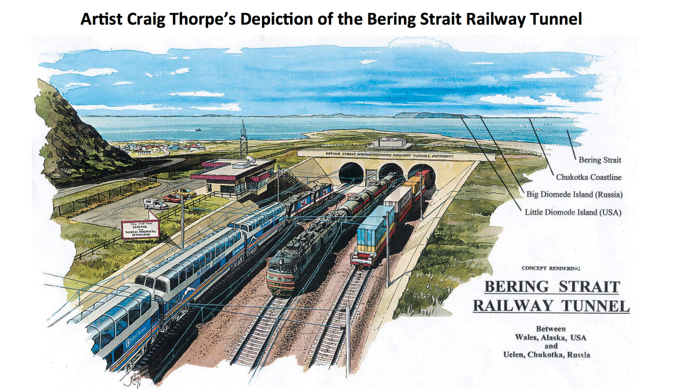 |
[Fig. 9] I commissioned Craig Thorpe to do a painting of what the Bering Strait Tunnel would look like if it were to be built. This is the eastern entrance of what the tunnel would look like, near Whales, Alaska at the end of the Seward Peninsula, as a three-track line. Then it would have passenger trains and freight trains, including a Russian locomotive hauling oil. There are considerable minerals in Alaska—coal, potash, oil, etc.—a lot of which could be hauled by rail.
Then, of course, there’s the development in parallel on the Russian side in Chukotka. There is an orderly plan that’s well underway in Russia, going between Skovorodino and Yakutsk, which is basically completed now. Except they need to figure out how they’re going to get to Yakutsk from across the Lena River, which is anywhere from three to twenty miles wide. Then, going to Magadan on the coast, then going up to Evensk, where they could go to the Kamchatka Peninsula and finally going out to the Bering Strait near Uelen in the Chukotka region.
Figure 10
View full size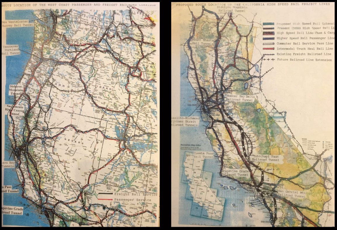 |
[Fig. 10] A critical part of this project involves the West Coast of the United States. These centers of the United States, being an increasingly important financial and technological region, need to be connected. We need to have a line coming down from Vancouver to Seattle, to Portland, to Grant’s Pass, Oregon. Then we need parallel lines going down through the Sacramento Valley to Sacramento, and then along the U.S.101 corridor through northwestern California from Eureka down to Santa Rosa. And then a tunnel under San Francisco Bay into San Francisco, to connect to where the terminal is, which would also connect to California’s high-speed rail project which does need to be built. I understand it’s in President Trump’s infrastructure plan, but it needs to get implemented and it needs to get built. We need a line down the coast as well as in the valley. We also need a line along the west side of the San Joaquin Valley in parallel to the California Aqueduct water course.
Figure 11
View full size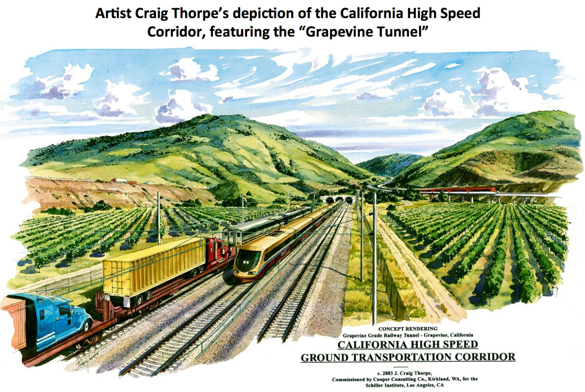 |
[Fig. 11] This is a picture of what a tunnel under the Grapevine would be, which is the grade south of Bakersfield to Los Angeles. It would require building a tunnel 32 miles long, very similar in concept to what has just been completed for the St Gothard Tunnel in Switzerland, which is 53 miles in total, with the main tunnel being 37 miles long. This would be very similar in concept, very similar in implementation, and it solves a big bottleneck.
I should tell you that the Desert Express privately financed high-speed rail line between Las Vegas and Palmdale that would connect to the California high-speed rail project going out through the Antelope Valley between Palmdale, Lancaster, and Mojave, would connect. Then you would have two parallel lines to Los Angeles: One over Soledad Pass, and one through Tejon Pass into the San Fernando Valley into Los Angeles.
Figure 12
View full size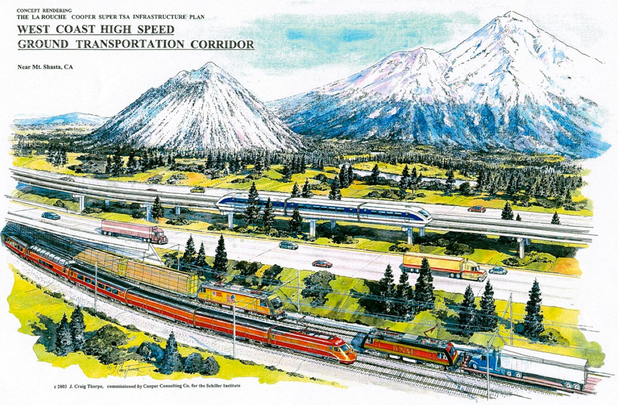 |
Figure 13
View full size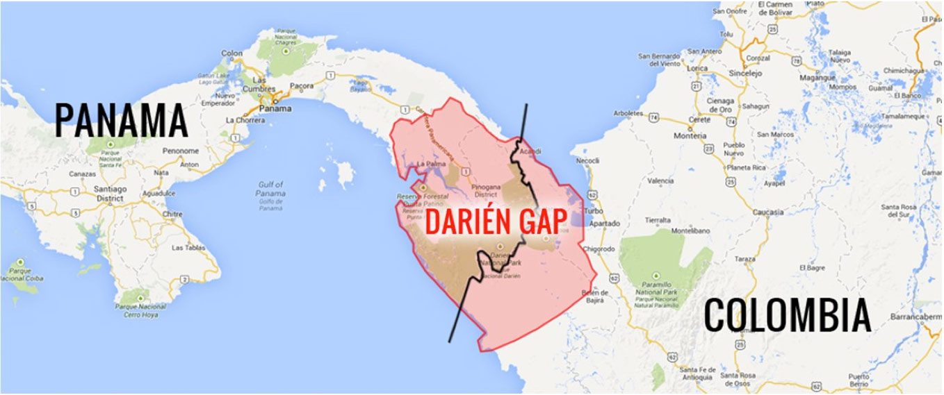 |
[Fig. 12] This is northern California. This is Mount Shasta, for those of you who have not recognized it. I show a maglev line and also a high-speed conventional line which would have both passenger and freight trains. I would like to see that modified so that instead of the old Southern Pacific colors, we had two new high-speed trains: one with the California high-speed rail color, and the other being the Amtrak Cascades which runs through the states of Oregon and Washington.
[Fig. 13] Now, we need to extend the system down into South America from the United States, and that’s going to mean going through Central America, through Mexico, Guatemala, Honduras, El Salvador, Costa Rica, Nicaragua, and Panama into Colombia. The Darien Gap is a formidable area and there’s a big swamp there. The best way to do it is to build it on the mountain foothills to the east and then have a bridge over the Gulf of Urabá—right there in far northwestern Colombia—to a place called Turbo, and then south. It would ultimately go to Bogota and other cities in Colombia and south into Ecuador and Peru. Then, connecting with these bi-oceanic railways that are now being proposed across South America, including the presence of the Chinese both in the northern and southern route through Bolivia, Brazil, Peru, and possibly Chile. There’s a separate one between Argentina and Chile.
Figure 14
View full size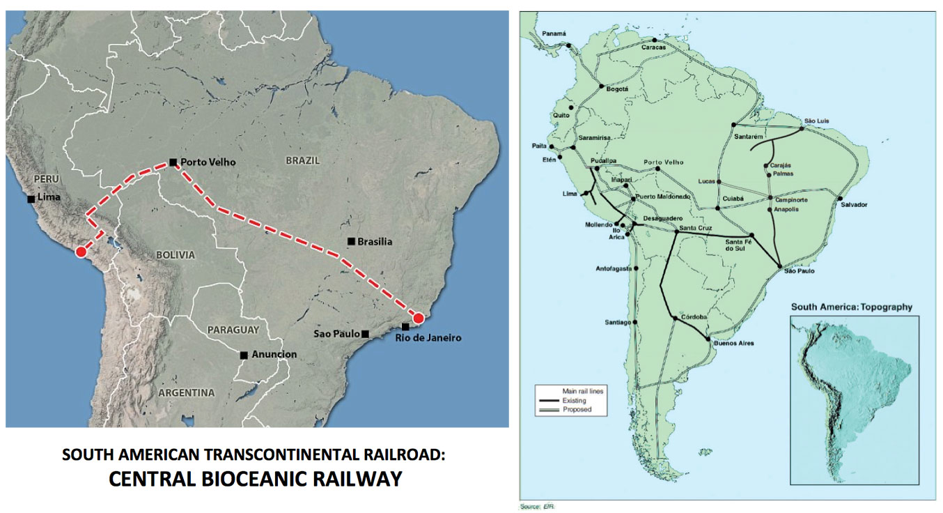 |
Figure 15
View full size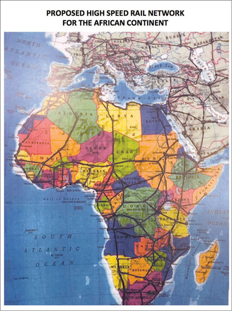 |
[Fig. 14] I’m showing you one of the northern routes for the proposed bi-oceanic rail system in South America, plus the LaRouche proposal for a railway network in South America which certainly needs to be built. We need to get rid of the political opposition that has attempted to prevent it in the past, as has been extensively discussed already at this conference.
[Fig. 15] This is the proposed rail network in Africa. I did an extensive feasibility study several years ago about a featured rail network in Africa which could connect all the countries. The Chinese basically have proposed doing the same thing for a major high-speed rail system in Africa, starting between Durban and Johannesburg in South Africa.
And I think we’re done. Thank you.