
 |
Conference Program
NEW WEBSITE: FORUM FOR A NEW PARADIGM
The U.S.A.: Dr. Howard Chang
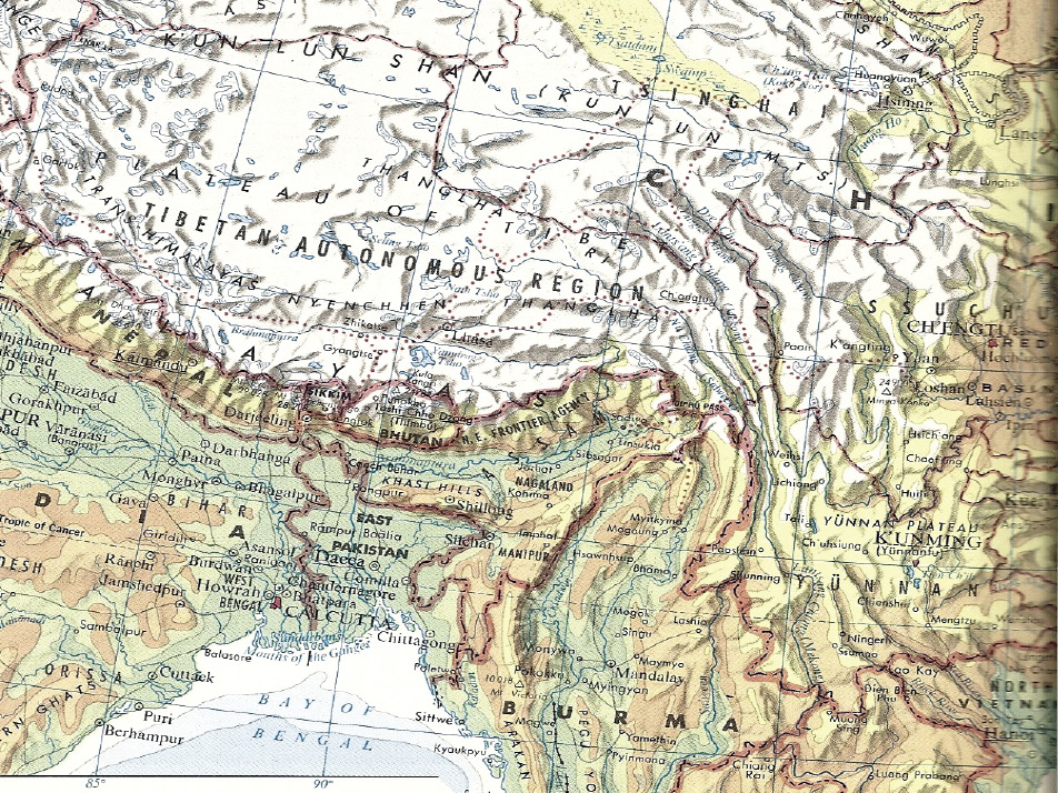
Water Development In the Pacific
Dr. Chang is a professor emeritus from the University of San Diego and a globally prominent hydraulic engineer.
I’m going to talk about major continental projects of the Pacific Basin. I’m sure you’ve gotten the impression that the Pacific Basin is rapidly moving to the center of the world community. Our emphasis today is to talk about especially major water- and transportation-related projects around the Pacific Basin, on the continents around the Pacific Basin.
I have selected five major projects. The first one is the Kra Canal, followed by the Nicaragua Canal; followed by the Three Gorges Dam. I personally worked on the Three Gorges Dam starting something like 30 years ago, so I can personally share with you my experiences regarding the Three Gorges Dam.
Let me tell you one thing right now—the idea was proposed by Dr. Sun Yat-sen. Later on, in China, some 30 years ago, it was opposed by certain scientists and engineers, because they said if you travel on the Yangtze River—anybody who has traveled on the Yangtze River has noticed that the water is muddy. The river is muddy in the Summer, and in the Winter, the only difference is between muddy, muddier, and muddiest, because it is muddy all year ’round. The chairman of the Chinese Academy of Sciences was opposed to the project; he said once you build the dam, you’re going to slow down the water flow; you are going to induce sediment deposition in the reservoir. Pretty soon, the dam will become a waterfall. It will become a permanent sorrow for China.
I will explain to you why the dam will not create a permanent sorrow for China, but, instead, it’s going to bring a lot of benefits, from different aspects.
Thailand: The Kra Canal
|
FIGURE 1
|
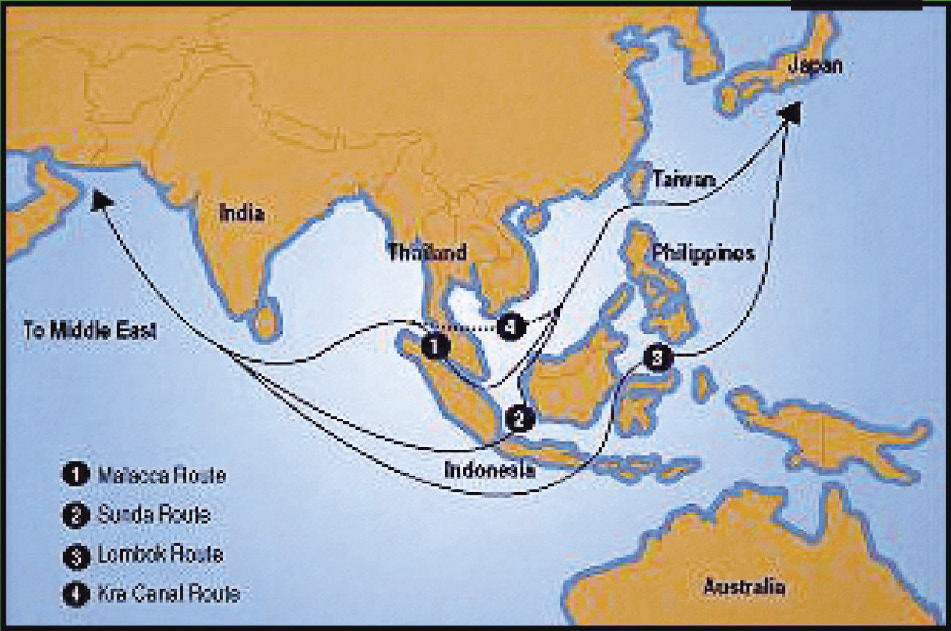
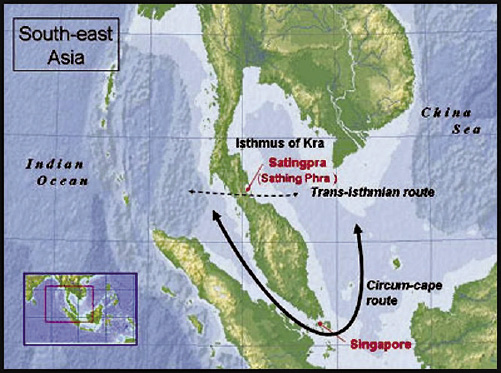
The Kra Canal is the first major project I wish to mention. Of the four sea transport routes (Figure 1), the first one [the Malacca Route] is via Singapore. When the idea of the Kra Canal was first proposed over 300 years ago, Singapore was strongly opposed to the project: Of course, it would take the shipping away from Singapore.
Things have changed, and for many different reasons we can look at these four different routes. There are two additional routes going through Indonesia—those are longer routes. But the shortest route goes through the Kra Canal. The significance is this: It connects two oceans, the Indian Ocean and the Pacific Ocean.
The traffic going via Singapore is more than twice the traffic going through the Suez Canal and the Panama Canal combined! And besides we’re beginning to see some problems with the current route. And we’re having different problems with the current Malacca Strait route—it is heavily traveled nowadays, and the congestion is beginning to become a problem, and that is increasing the cost of shipping, of course. Right now, the traffic around the Malacca Route is increasing at a rate of 200,000 ships annually. A more recent estimate is that the traffic through the Strait is increasing at an annual rate of 20%.
Mr. LaRouche has brought up this idea, and has made contributions over the years to promote the construction of a new canal—the Kra Canal.
Okay, let’s take a look at the Malacca Strait in its current conditions: We’re talking about a width—a narrowing width—of 1.6 miles. The depth is as shallow as 25 meters—that’s pretty shallow, especially for oil tankers nowadays, and it is heavily used by oil tankers and bulk carriers. Some 80% of Japan’s oil supplies go through the Malacca Strait.
|
FIGURE 2
|
FIGURE 3
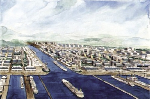
Artist’s View of a Kra Canal
|
From a security standpoint, the Asian countries—Japan, China, all those countries of the region combined—are concerned about the security of the Malacca Strait. Hopefully, there will be no regional conflicts that can disrupt the oil flow. You know, oil is a lifeline for Japan, as well as for China, for South Korea, for all those countries. So therefore, if you open a second route, that would actually improve the security for transportation and for traffic in that region (Figure 2).
Of course, the construction of the Kra Canal would stimulate a lot of growth in that area. (Figure 3) shows commerce and industrial development at both ends of the canal. There could be another Singapore! You know Singapore is a very affluent country—a very advanced country—this could be a second Singapore. Although this idea was opposed by Singapore—in fact, by the United Kingdom—a long time ago, because Singapore was a British colony.
However, because of further considerations, it is very important that the Kra Canal be promoted, be constructed. But for every project there are challenges, and there are controversies for Kra Canal.
Let me tell you the challenges first: It is not feasible to build an elevated canal; it has to be a sea-level canal. To build an elevated canal you need a big body of water, because locks and dams consume a lot of water. But for this canal, there’s no large body of water, there’s no lake. So it would be the most logical to build a sea-level canal. But the sea level has to cut through the mountain range—that is the challenge.
Think about this: It involves a tremendous amount of excavating and earth-moving. It could be the largest earth-moving project ever undertaken by man. You have the total expenditure for doing that. But—but, it is being contemplated and being considered that we could have the peaceful use of nuclear power for the excavating and earth-moving in the creation of the Kra Canal.
Now recently, China is considering calling for the construction over ten years, employing something around 30,000 workers, costing between $20 and $25 billion. That is the latest development, and, I don’t know anymore than that.
The Nicaragua Canal
Now, let’s move to the Nicaragua Canal (Figure 4). That will be a second canal connecting Pacific and Atlantic oceans, second to the Panama Canal.
|
FIGURE 4 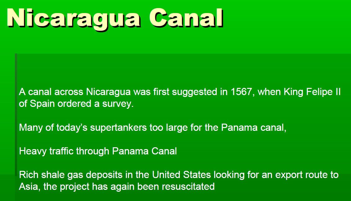 |
This idea was suggested as early as 300 to 400 years ago. Today, many of the supertankers can no longer go through the Panama Canal, and the Panama Canal right now also has traffic congestion. It has become time-consuming to go through the canal, because you have to go through a series of locks and dams. But, they do have a freshwater lake that supplies water used by locks and dams, that is the advantage.
However, the Nicaragua Canal has been determined by the business-scientific-industrial community to be a useful canal; once completed, it will be heavily used because the Panama Canal has limitations, and also because the traffic is getting heavier all the time.
|
FIGURE 5
|
FIGURE 6
Locks on a Proposed Nicaragua Canal
|
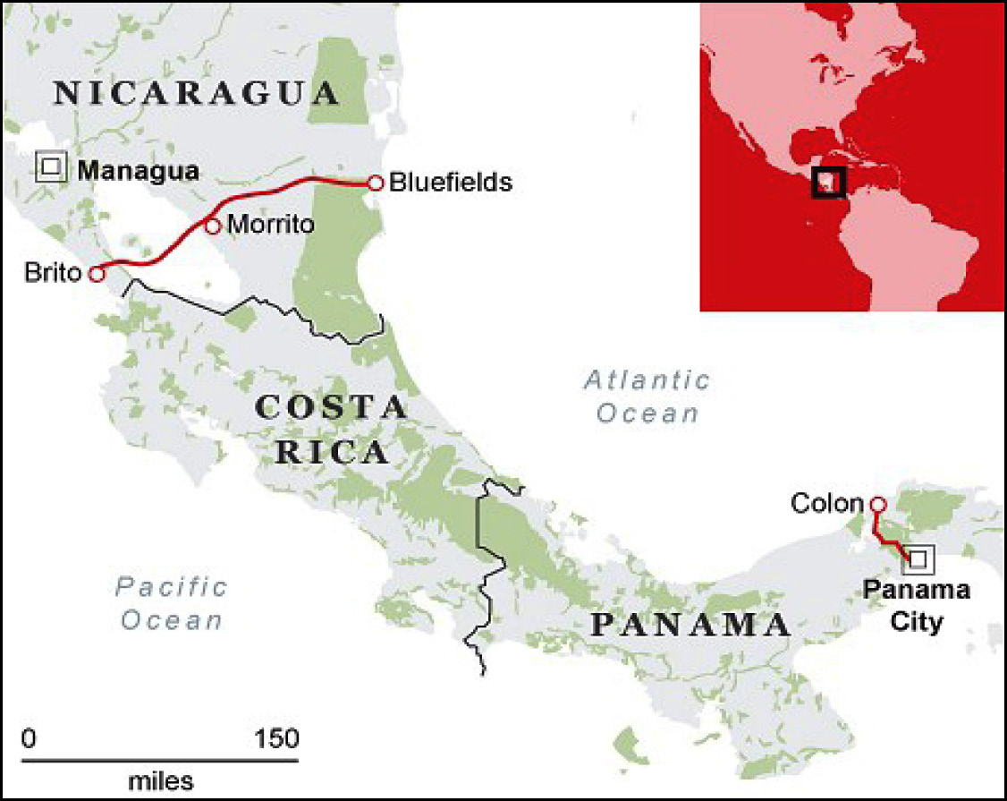
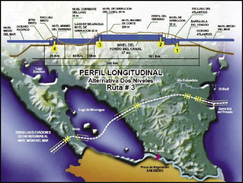
Now, let’s take a look at the location of the Nicaragua Canal (Figure 5). We see the location of the Panama Canal, Costa Rica; next to Costa Rica is Nicaragua. Building a canal here, connecting two oceans, would involve an elevated, raised canal for several reasons. One, there is a tidal difference between these two oceans, a tidal difference that can be as much as 20 feet; so the water level going through the canal does need to be controlled, and we are going to raise the water level when traffic is going through the canal (Figure 6). It’s in different stages going through the locks and dams, and to raise the canal up, water will be used from the freshwater lake—and it happens to be a very large lake. The large lake is very important—well, it makes the canal feasible—but also creates some problems and challenges.
Lake Nicaragua is the mother lake for the country of Nicaragua. There is opposition to heavy ocean-going traffic going through the freshwater lake. In fact, the past President, [Daniel] Ortega, was opposed to the project. He said that the freshwater lake is so important—it’s the mother of our country—that we are not going to allow heavy ocean-going traffic through this canal, not only from an environmental aspect, but also from an emotional viewpoint.
So, that’s the current status.
But have we heard new interesting, recent developments? Financially, is anyone interested in building it, picking up the big tab to go ahead with the construction of the canal, which is estimated, roughly, to be a $40 billion project? I told you that the container ships go through a series of locks and dams where the water level can be raised or lowered. So the canal can be raised to a much higher elevation, with water supplied from Lake Nicaragua. I also told you about the problems and considerations and the challenges.
There is a recent proposal by a gentleman, Mr. Wang [Jing]. I don’t know how real or realistic this is going to be, but he made an announcement: He’s proposing that he will provide the financing of $40 billion for the construction of this canal. This gentleman has a very interesting background—he happens to be a businessman, and I think he is stationed in Hong-Kong. It will be very interesting to find out what happens next.
But this project is being considered, and there’s indeed a need for the construction of this canal, because of the traffic problem in the Panama Canal, the time-consuming problems, and because of the problem of the size of that canal.
South-North Water Diversion in China
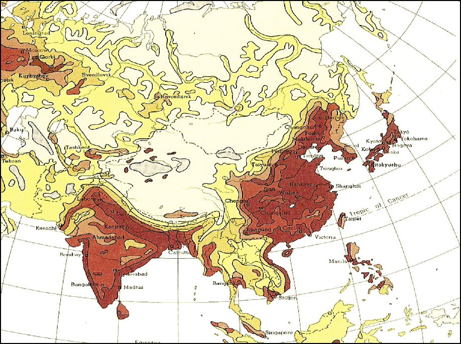
Next I’m going to talk about the South-North Water Diversion project in China. Figure 7 shows China and the United States: two countries with similarities, but very strong dissimilarities. Similar latitudes, similar size—except the population densities are very different. China has 1.3 billion people, while we only have 300 million people in America. And America is very fortunate, because our precipitation occurs from coast to coast, fairly evenly distributed, and not only spatially distributed, but also well distributed seasonally. Seasonal distribution is fairly uniform in America; but the rainfall distribution in China is highly uneven. It is concentrated in the Summer and Spring. It’s also concentrated in the Southeast, and becomes very sparse in the Northwest.
|
FIGURE 7
|
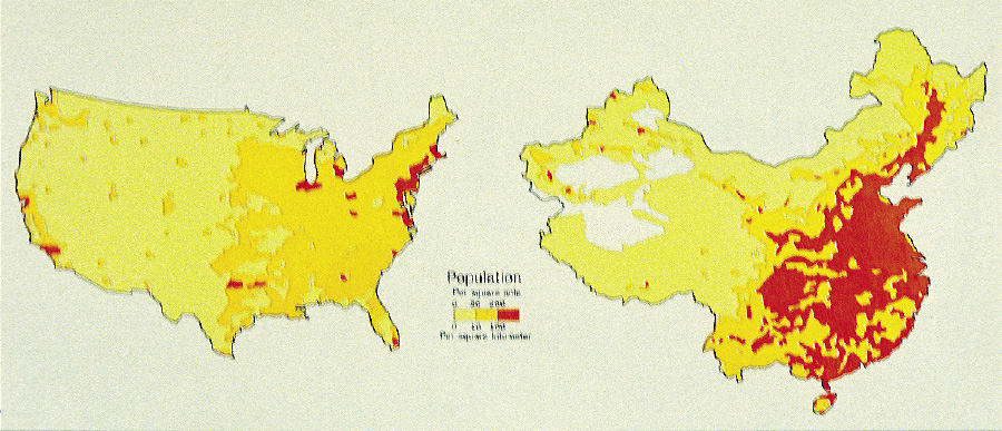
Let’s look at the water resources of all the countries of the world. One country where water resources are most abundant is—guess what—Brazil. You know there’s a lot of trade between Brazil and China—and Brazil says, “We have everything China needs, we have water China needs, except we don’t know how to sell water to China.” Well, Brazil is number one, in terms of abundance of water resources, followed by Congo, followed by Indonesia, then the United States, then Russia, and then China.
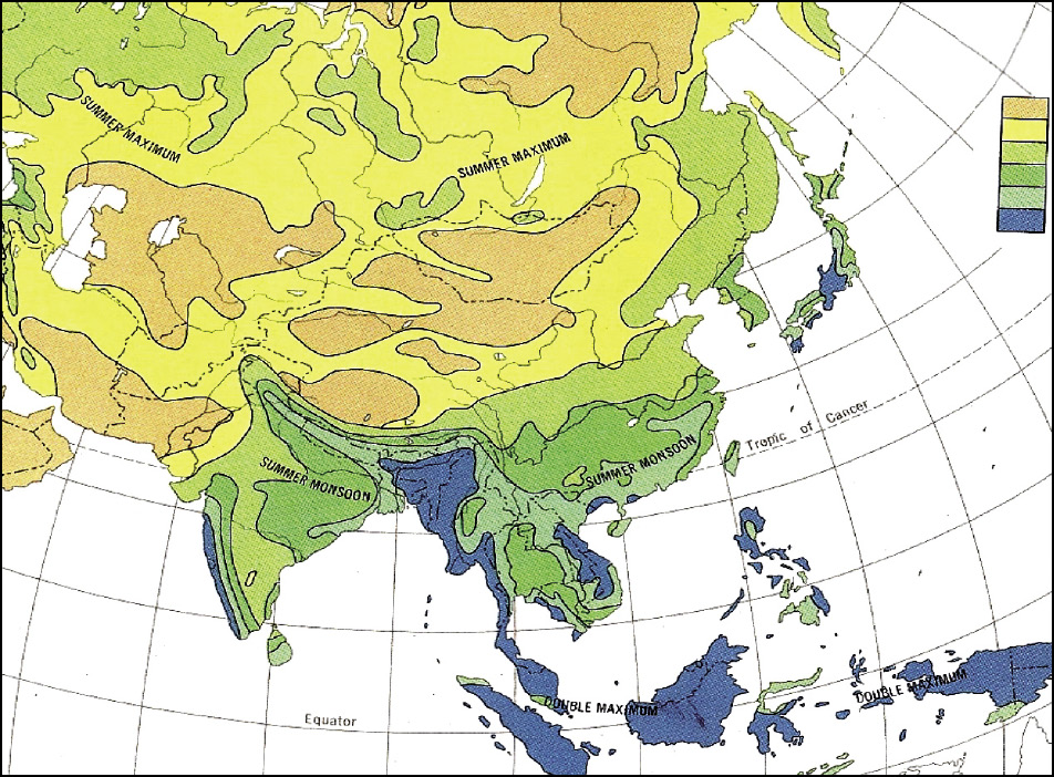
China is number one in population, but number six in water resources. Which means water distribution, water conservation, water storage become very important in that country. If you look at the precipitation patterns (Figure 8), you can see that there’s much more precipitation in the southern coastal area, which becomes less and less as we go north and west.
|
FIGURE 8
Asia’s Rainfall
|
FIGURE 9
Asia’s Population
|
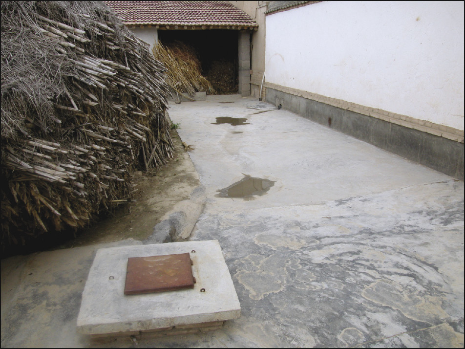
But, if you look at population distribution (Figure 9), the population distribution is from the south to the north: Water becomes much more scarce in the north. It is logical for us to redistribute water from the more abundant area to the less abundant area; we have to divert water from the south to the north. In the north, water has become so precious: I visited some peasant families not too long ago, and they even collect water in their yard (Figure 10). You see? When it rains they collect water, and the water is stored in a water storage tank. This is rainfall water!
|
FIGURE 10
|
FIGURE 11
China’s Planned Water Diversion Routes
|
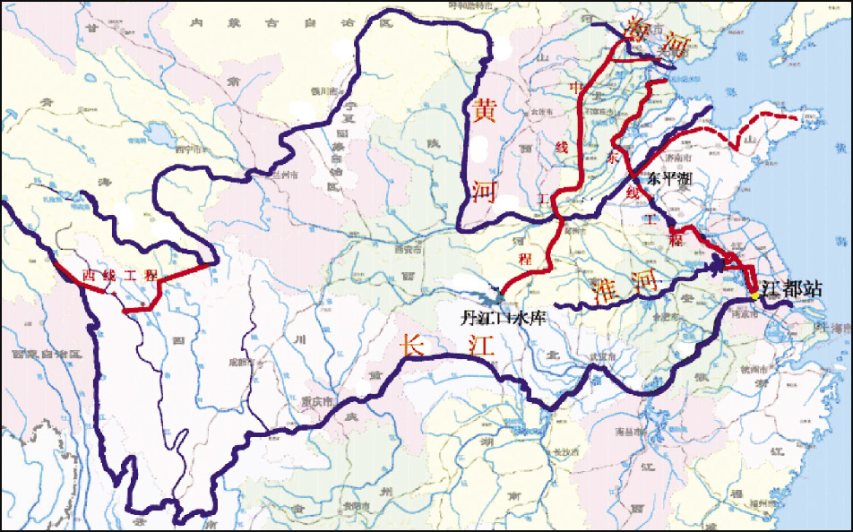
Now, let’s talk about water diversion projects. There are three different routes (Figure 11), to divert water from the south to the north. There’s the Eastern route, taking water from the Yangtze River to the north, to the harbor city of Tianjin. The Central route is also taking water from a tributary of the Yangtze River to Beijing; and, the Western route is taking water from near the Tibetan plateau, by diverting water from the Yangtze River to the Yellow River.
Now these three routes combined would take roughly 7% of the water from the Yangtze River Basin to the north, to the Yellow River Basin.
Let’s take a look at details of the Eastern route, The Eastern route (Figure 12), starting from the Yangtze River—you can see the three different phases. Phase 1, starting from the south, then going to the center, and there’s a tributary to the tip of the peninsula and all the way to the harbor city of Tianjin. It goes through a series of lakes, this part is already completed—the intake station at the Yangtze River is already constructed, completed, to take water from the Yangtze River and send it to the north.
|
FIGURE 12
|
FIGURE 13
|
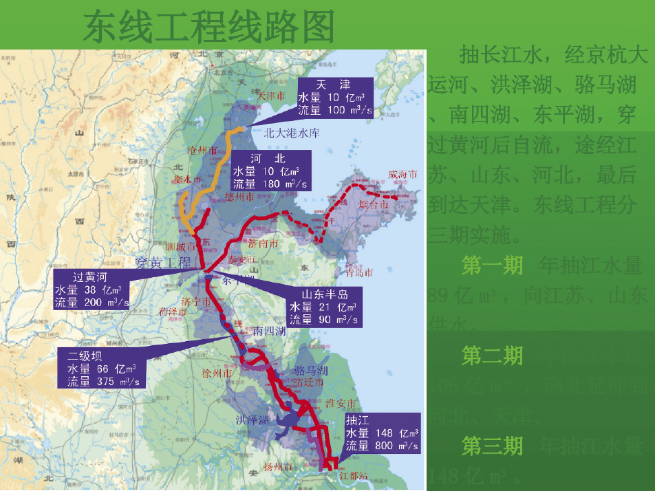
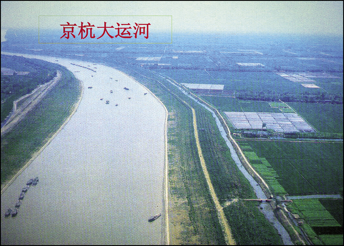
Figure 13 shows the canal, the ancient canal, which has been improved, enlarged, and deepened, to increase its capacity for transporting water from the south to the north.
|
FIGURE 14
|
FIGURE 15
The Western Route
|
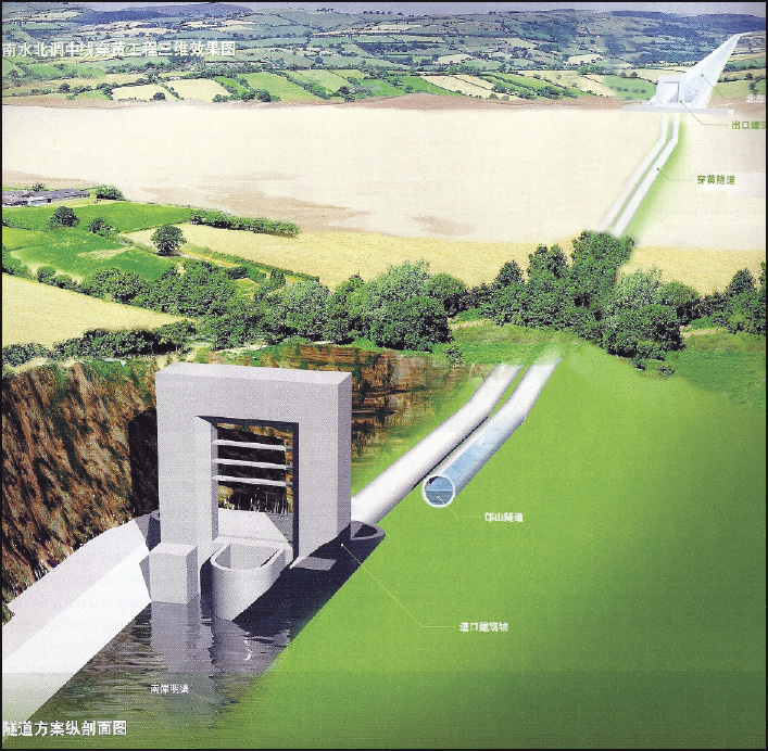
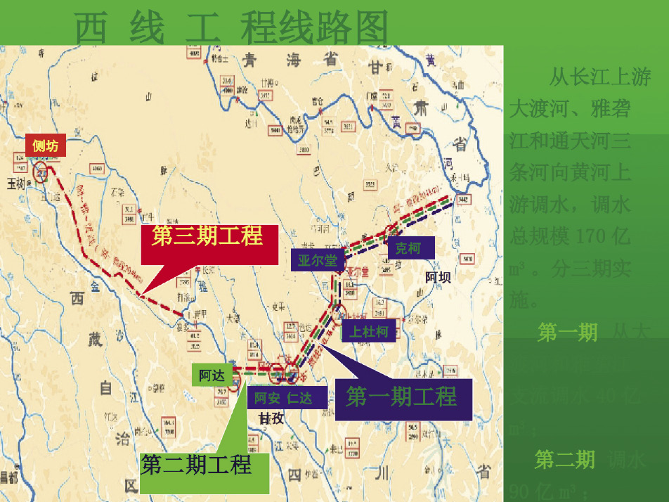
Figure 14 is a tunnel under the Yellow River: These are very, very huge tunnels which take the water toward the north. The Eastern route has a number of pumping stations to cross the Yellow River. The Yellow River is not a point of water concentration; the Yellow River is a point of water divide. You know why? Because the Yellow River is an elevated waterway. It has a heavy sediment content. Over the years, people have been building up the levees, year after year, generation after generation—the riverbed of the Yellow River is much higher than the adjacent fields. So when the water goes from the Yangtze River to the Yellow River, it has to go through a series of pumping stations, and after passing the Yellow River, that water will flow by gravity all the way to the city of Tianjin.
The Western route (Figure 15) is very, very impressive, because that area is so mountainous. The route has to go through so many mountains, through so many river valleys. The most mountainous area is right at the edge of the Tibetan plateau. So, that is going to require a large expenditure.
|
FIGURE 16
|
FIGURE 17
|
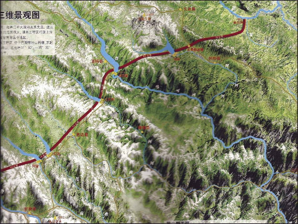
In Figure 16 you see the route of the diverging canal. The route is going to go by canals, by pumps, and by tunnels, many tunnels, going through a series of reservoirs. That construction would be very difficult, because that area has so many high mountains. Do you know that the average elevation for the Tibetan plateau is 5,000 meters?! (Figure 17)
I remember just a few years ago, I had a chance to visit Tibet, and I stayed at the tallest hotel in the highest city of the world, getting into the Guinness Book of World Records. That hotel has an altitude of 15,000 feet! I could feel the difficulty in breathing. And also the air pressure is so low—people told me that if you boil water—water boils not at 100°Celsius, but at 69°Celsius. I asked them: “How do you cook? You may not be able to fully cook food, because it boils at such a low temperature.” They said: “No problem, we’ve got pressure cookers.” That’s my personal experience.
By the way, it was very difficult, because it becomes very strenuous. While I was walking down or walking up the stairs—every five steps I’ve got to stop for a while so I can catch my breath. So, think about the construction of this water diversion system. This project has not yet been started.
You may wish to know the status of the three lines for water diversion. The Eastern route is on the way to completion, I’d say maybe in a couple of years, because the start-up project was maybe ten years ago. The Central route is also near completion; in another two or three years that route will be completed.
What about the cost of construction? For the Eastern route and the Central route for water diversion the total cost is $60 billion. It also involves the resettlement of people: They have to resettle 600,000 people for the completion of these two diversion routes. That is a very difficult task. In a country like that, they can still do it; but in this country [the United States], if you wanted to resettle not 600,000, but 6,000 people, I think it would be an impossibility. I don’t know how to say this [laughter]—but we would have a lot of difficulty! I live in San Diego, and I remember when they built highway 56, it took them 26 years! From the time of planning to the time of completion of the freeway, it took them exactly 26 years. Right? There were a lot of lawsuits: eminent domain, land use, land acquisition.
You know what? [In China,] ever since the Communist Revolution, there has been no private ownership of land. So the government owns the land, and that makes it a lot easier for public works on the Tibetan plateau. They had an opening ceremony for the construction of this water diversion project.
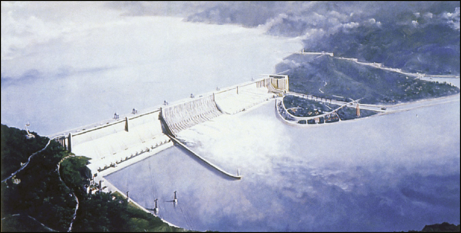
The Three Gorges Dam
|
FIGURE 18
Three Gorges Dam
|
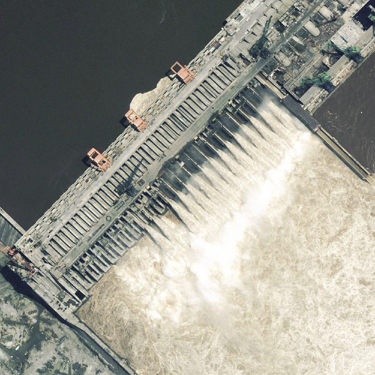
FIGURE 19
|
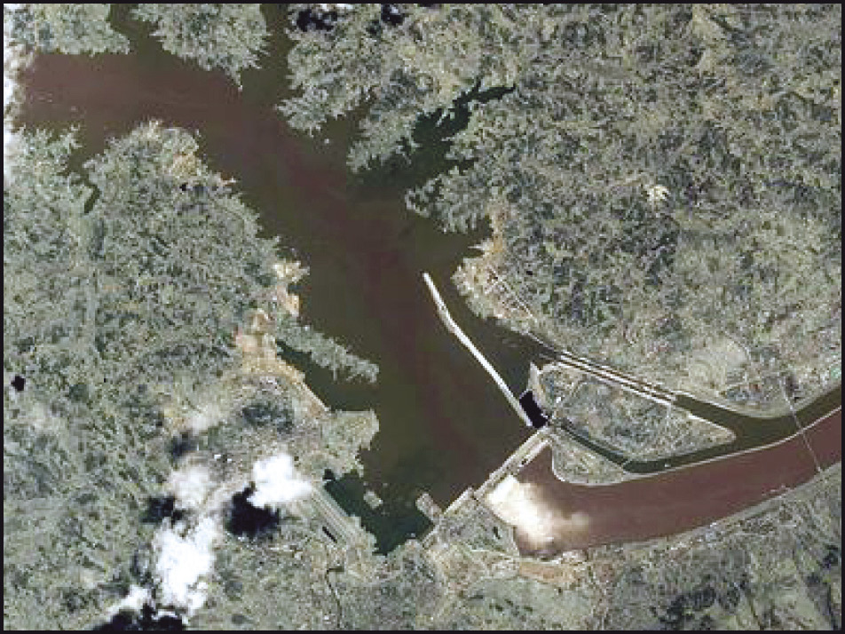
Now I want to talk about the Three Gorges Dam. As I told you, I started working on this project some 30 years ago. This project was first proposed in Beijing by Dr. Sun Yat-sen, whom Leni [Rubinstein] just mentioned. He really had the vision, he said: We are going to get this inspiration, and this idea, from the TVA projects. You know the TVA—it has a network of dams and hydropower stations, that can generate tremendous rates of hydropower, and this project has many benefits. Figure 18 shows the completed dam now.
Figure 19 is a close-up of the project, showing the completed project. Figure 18 was taken from a satellite. You can see that water was released through the sluice gates. You know that this water is muddy, as I mentioned to you.
When this project was proposed, there was a lot of opposition, including the President of the Chinese Academy of Science. He said: The water is so muddy, and sooner or later, the velocity will slow down in the reservoir, and the reservoir will be filled up with sediment, eventually, if not in 100 years, perhaps in 500 years. So that reservoir is going to become a waterfall, its function would be lost, and it would become a permanent sorrow for China.
Well, our mission was very simple: to determine how to control the reservoir, to design the reservoir, to build the reservoir such that the capacity of the reservoir can be preserved in perpetuity. There were all kinds of studies—there were physical modeling studies in the laboratories to find out how the reservoir behaves, as the water and the sediment are released and pour through the reservoir. There was also computer modeling of flood flow going through the reservoirs.
The part I got involved in was computer modeling of the water and sediment flow going through the reservoirs. I can tell you very briefly, because if I have to go into the details it may take a couple hours. This reservoir will be silted up; but the percentage of sediment in the reservoir would only take away, roughly, 40% of the reservoir capacity, in the very long term; 60% of the capacity of the reservoir will be preserved in perpetuity.
Then the question was: How can you say that? Why do you figure that’s true?
|
FIGURE 20
|
I can tell you very briefly: There are many reasons why that is going to be true. This reservoir is very different from Lake Meade. Many of you have seen Lake Meade, right? If you stand on top of Lake Meade—on the Hoover Dam, overlooking Lake Meade—you notice the water is clear. . . . Do you know what message I get? No sediment can escape Lake Meade; all the sediment will settle in Lake Meade. However, if you look at this picture (Figure 20), you see that even the outflow of the water is muddy. Now, that’s because Lake Meade is a storage reservoir; it has a round shape. This reservoir [in China] is a river reservoir; it’s a long and narrow reservoir on the river channel—that’s one thing. Second, there’s a flow, and the flow will always move the sediment. When the reservoir is silted up, people will think the reservoir will become shallower and shallower, and sediment will build up from the bottom, right? That sediment builds up from the bottom of the reservoir, and the river will become shallower and shallower? Not so!
You want to know what really happens? From physical modeling and from mathematical computer modeling, we found out that sediment deposits will, basically, be along the banks, which means that eventually the river will become narrower, but still as deep, almost as deep as it is today. In other words, once the reservoir fills up, it will become more like a river channel, because the siltation will simply reduce the width of the river reservoir, not so much the depth of the reservoir. So, as long as there is a flow, the flow will always make a channel in the river reservoir. And, the flow of the Yangtze River is tremendous; that flow itself will always preserve the capacity of the reservoir.
A tremendous amount of water goes through the reservoir, going through sluice gates.
|
FIGURE 21
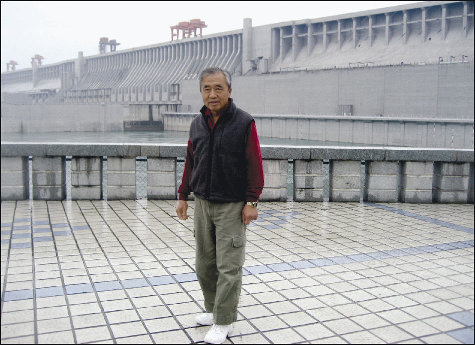
Dr. Chang at the Three Gorges Dam
|
You see, I was there only two years ago (Figure 21), do you know what happened? When I was there, there was a record drought . . . in the area just downstream of the reservoir. Do you know what the people blamed? “It’s the reservoir, the Three Gorges Dam, that actually caused a record drought in the area, downstream of the reservoir.” In other words, in people’s opinion, the construction of the dam and the reservoir had changed the climate, the precipitation pattern of the Yangtze River Basin! Well, I’ll tell you what—this point was not addressed in an environmental impact report!
I cannot relate the change of precipitation pattern to the presence of the reservoir. People have wild ideas.
Let me tell you another wild idea: During the planning stages of the dam, people wanted to study the impact of the reservoir and the dam; they said that the impact of the reservoir and dam would change the Earth’s rotation! [laughs] . . .
Figure 22 shows the inside, where visitors who visit the dam and the power plant, could not go, but because we were guests of the Chinese Water Resources Bureau, we had the privilege of getting in. This is a powerhouse; the top part is a generator, driven by the turbines; the turbines are submerged in water. . . .
|
FIGURE 22
|
FIGURE 23
Indoor Model of the Dam Project
|
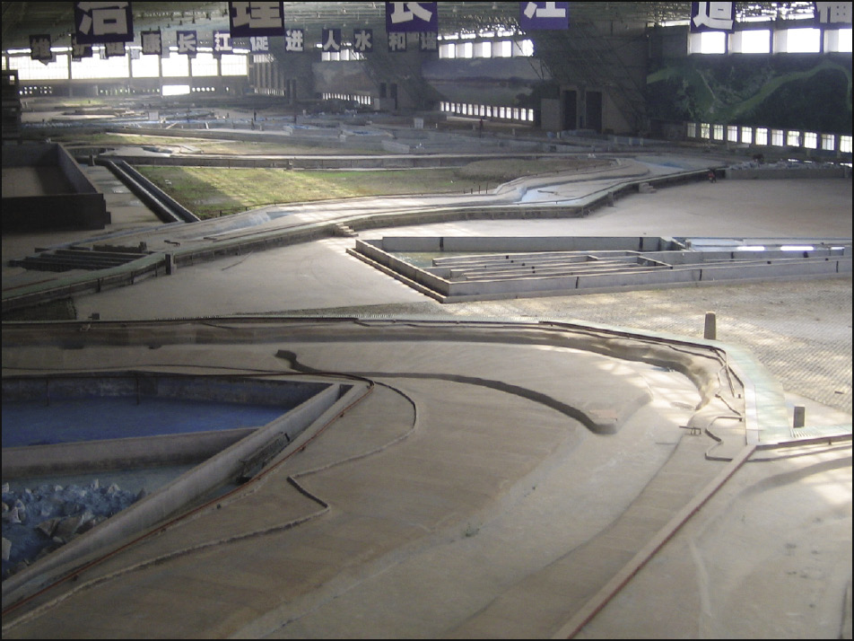
I mentioned to you that when they built this reservoir and dam, they did a physical modeling study in an indoor laboratory. I couldn’t believe the size of the indoor physical model (Figure 23)! I’ve never seen and couldn’t believe the size of the indoor physical model, I’ve never seen such a super indoor laboratory in my entire career. You know, we have a lot of hydraulic laboratories, the largest one being the Vicksburg, Miss., waterways experimental station of the Army Corps of Engineers; but they are not even one-third of the size of this indoor laboratory in China used for the study of the Yangtze River and the Three Gorges Dam.
Now let’s look at the project benefits.
The major benefit of hydropower is quite apparent, because the energy is very cheap. I want to give you one example: Do you know the San Onofre [nuclear power plant] in San Diego County, the Diablo Canyon? We have two nuclear power stations there. Now San Onofre is 2.2 gigawatts; the revenue it got, as of ten years ago, which I know, was $2.2 million every day! But to run that nuclear power plant, the expense is very high: $2 million. So the profit margin is very small. Why? Because nuclear power plants have very, very strict security measures. There are 3,000 people working at a power plant, and many of them are working on the subject and aspect of security, nuclear power security.
But what about energy? You know the Feather River in Northern California: The Feather River has three-stage power-generating stations; they produce 1 gigawatt, equivalent to one nuclear power plant. Their revenue is about $1 million per day. But what about expense? The expense approaches zero. Why? Because for hydropower, the fuel is free! You don’t pay for the fuel, you don’t pay for the transportation of the fuel. They only have 16 people working that entire canyon. The salary expenses are very, very small. So you can see right away that it is very cheap energy.
|
FIGURE 24 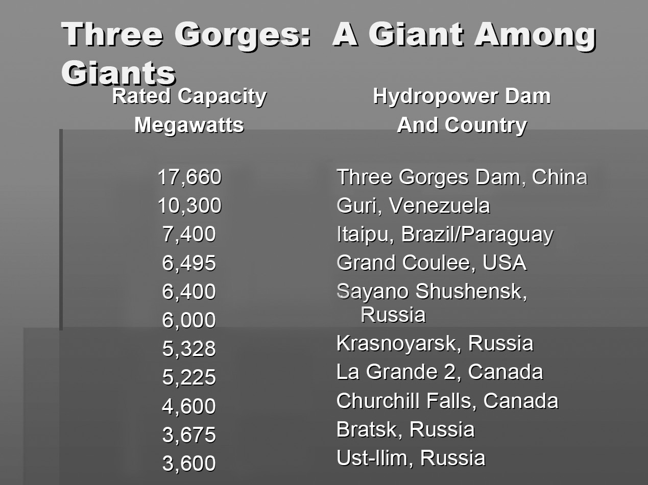 |
There are many, many benefits. But I want to mention something else: You may wish to know hydropower plants of the world (Figure 24). The table shows the rated capacity, the hydropower dams, and the country which it belongs. The Three Gorges Dam has the capacity of 17.6 gigawatts—that’s by far the largest hydropower station in the world. Followed by Guri of Venezuela, Itaipu in Brazil, Grand Coulee Dam in the State of Washington—that’s 6.4 gigawatts. What about the Hoover Dam? The Hoover Dam is not on the list, but the Hoover Dam is so important for the energy supply of Southern California.
Well, let’s see, what is 1 gigawatt? Do you have any ideas? One gigawatt normally is the typical capacity of one nuclear power plant. So, to give you some idea: The Three Gorges Dam has a rated capacity, roughly, equivalent to 17.6 nuclear power plants. Do you know how much revenue it generates? Using ten years’ [average] price, it generates something like $17.6 million a day. What about the expense for producing the energy? The construction expense was very high, but the operating expense is very low, because you don’t have all the safety regulations that a nuclear power plant does. So, therefore, the advantage of hydropower is apparent.
NAWAPA
|
FIGURE 25 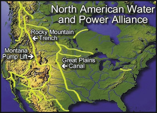 LaRouchePAC
|
I want to go quickly to NAWAPA (Figure 25). This really is a vision of the North American continent, as well as the world community, because this network of water distribution systems—reservoirs, dams, channels, pipes, culverts, and so forth—redistributes water from abundant areas to the water-scarce areas. That is going to generate so much wealth in North America. And let me say this: NAWAPA is the vision of the future. NAWAPA will have a lot of pumping stations. You have to pump water up, and let the water go down. But once water is pumped and then the water comes down, it also drives hydroturbines. Energy is also generated by the water distribution system of NAWAPA.
They are building the water-supply systems of California. They have pumping stations, and at the same time they have a lot of hydropower generators, because whatever water goes up, when it comes down, they can actually generate power.
 |
You know they have the maximum use of nuclear power in France. Germany is trying to minimize the use of nuclear power, but France has extensive use of nuclear power. But, nuclear energy is produced at a constant rate; you cannot change the rate, you cannot adjust the power rate. Sometimes they produce too much energy, and sometimes they do not produce enough energy. So, whenever they produce too much energy, that energy has to be stored. How do they store the surplus nuclear energy? Batteries? We don’t have batteries of that size! And, batteries would have to be at such a heavy capacity. But let me say this: Reservoirs are nature’s batteries. The water is pumped up into reservoirs—that’s where the energy is stored. Whenever they need that additional energy, the water comes down—from the reservoirs to the hydroturbines to generate energy.
So, reservoirs are nature’s batteries for energy storage. I simply cannot help thinking—whoever came up with this idea, it starts in the ’60s, had a tremendous vision—that this is the cause we’ve been striving for. We hope, someday, NAWAPA will be realized.